Just days after government warned the media against publishing images of President Jacob Zuma’s controversial Nkandla private homestead, TechCentral — working in collaboration with Eyewitness News — can exclusively reveal detailed new aerial imagery of the estate, upgrades to which have cost taxpayers R208m.
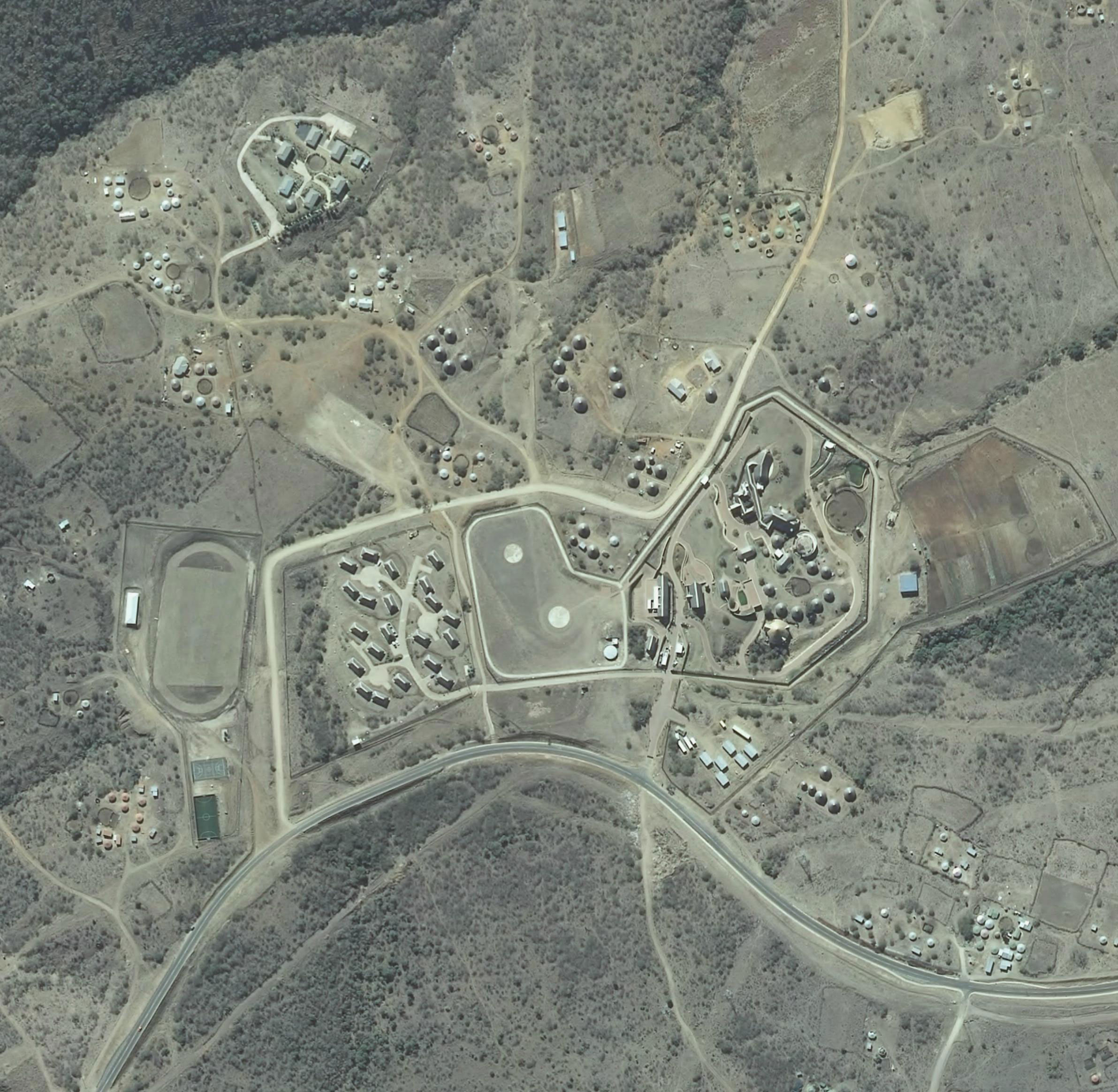
The high-resolution imagery, obtained by TechCentral and available for download below this article, reveals the extent of development at Nkandla in the past three years, offering a bird’s eye view of some of its more controversial features — including twin helipads, an AstroTurf sports field and a vast entertainment area.
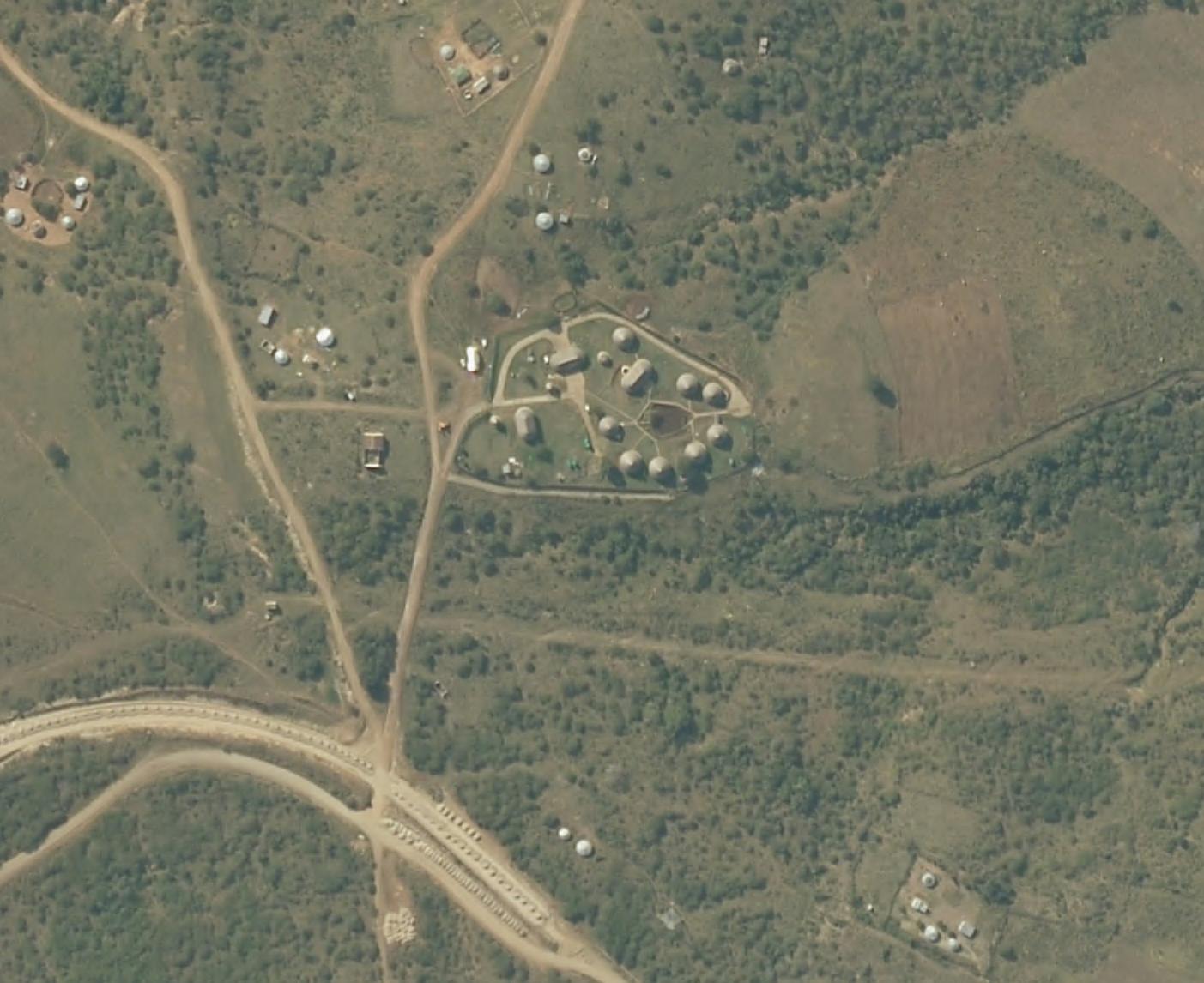
It also shows the controversial tarring of the road running past the estate, which connects the towns of Nkandla and Kranskop. The road upgrade reportedly cost R582m.
The imagery also appears to show that construction at the Nkandla estate has been completed.
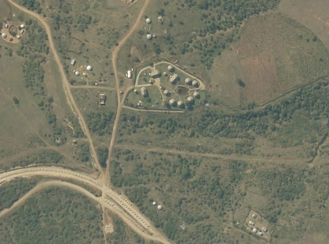
An image, believed to be from May 2009, of President Jacob Zuma’s then much more modest Nkandla homestead. Download a higher resolution version of this image at the end of this article
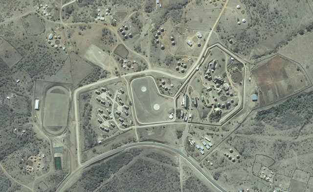
Aerial image of the Nkandla homestead, taken in August 2013 – note the original rondavels in centre-right of this picture. Download a higher resolution version of this image at the end of this article
The latest aerial image, above, which was taken in August 2013, is not yet available through Google Earth or Google Maps, both of which are still showing an image believed to have been taken in May 2009, at around the time Zuma took office. That image can be viewed using the following GPS coordinates: 28°50’42.73″ S 31°05’59.47″ E.
Online mapping services, including Google Maps, may be updated with the new imagery in the coming months.
Microsoft’s Bing Maps has what appears to be a slightly more recent image, taken by a different imaging provider. It shows construction work related to the upgrade to Nkandla already under way (see below). The date of the Bing image is not known.
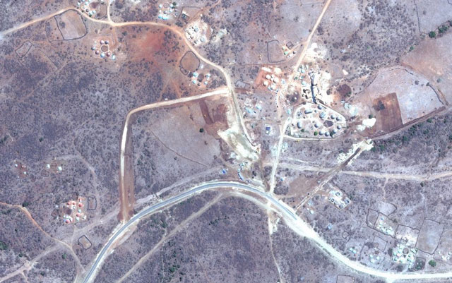
An image available through Bing Maps … date unknown
In 2010, the Nkandla homestead was declared a national key point by police minister Nathi Mthethwa. Last week, state security minister Siyabonga Cwele asked the media to stop publishing images of Nkandla as, he claimed, they posed a security breach in terms of the apartheid-era National Key Points Act.
“In terms of the National Key Points Act, no one, including those in the media, is allowed to take images and publicise images even pointing where the possible security breaches are,” Cwele said.
The minister said he was making a request to the media, but that government would consider those who ignored it to be breaking the law.
“At this stage, we are just appealing. We are appealing to the South African public. It is not done anywhere; no country does this. We have not seen the images of the White House showing where the security features are. It is not done in any democracy, in any country,” Cwele was quoted as saying.
His comments prompted defiance in the media, with many newspapers publishing large images of Nkandla on their front pages the following day. — (c) 2013 NewsCentral Media
Download the full-resolution images:
Nkandla, taken in August 2013
Nkandla, believed to have been taken in May 2009
No comments:
Post a Comment